Ireland's Highest Mountain Is A Difficult, Wildly Rewarding Climb With Sweeping Ocean Views
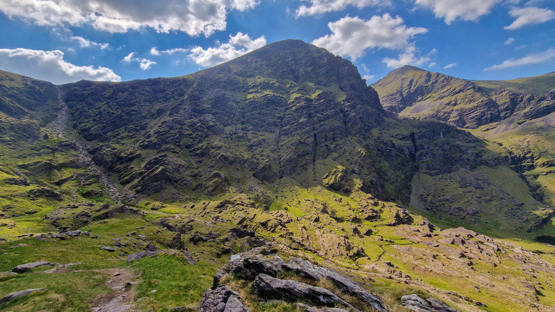
Among the many majestic mountains to see in your lifetime, one that you may not have heard of is Carrauntoohil, Ireland's tallest peak. As difficult to climb as it is to pronounce (that would be KURR-awwnn-TOO-hel), it belongs to a mountain range known as the Macgillycuddy's Reeks on the Iveragh Peninsula in the southwest part of the island. These are the country's highest mountains, with three peaks higher than 3,281 feet (1,000 meters): Binn Chaorach (3,314 feet), Caher (3,284 feet), and Carrauntoohil (3,409 feet).
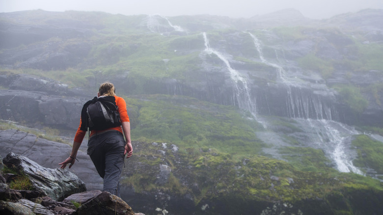
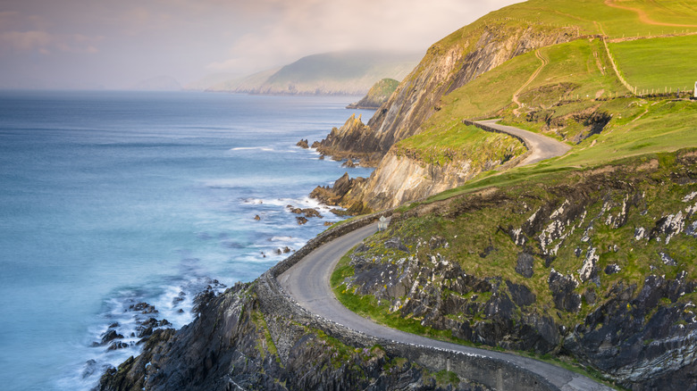
The green behemoth is often shrouded in mist, creating a ghostly environment for those who dare to attempt to climb it. But when the eerie mist clears, hikers are rewarded with sweeping views of emerald hills and glistening lakes, all the way to the Dingle Peninsula and the fiercely blue Atlantic Ocean. The difficult hike takes around six to 10 hours, depending on your preferred pace, with the four most common routes (in ascending order of difficulty) being Devil's Ladder, Brother O'Shea's Gully, Stumpa an tSaimh (Hag's Tooth) Ridge, and Coomloughra Horseshoe. Before embarking on your adventure, check out these tips from travel pro Rick Steves on hiking in Europe.
Explore the easier Carrauntoohil summit trails
Most hikers choose the 6.8-mile (round trip) Devil's Ladder trail, a fun and memorable traverse through the dreamy Celtic landscape to the tippy-top of Ireland. This trail starts in a place called Cronin's Yard, crosses a river, and then passes through a lush green valley before arriving at the 'ladder' — a steep and rocky climb that leads to a ridge and then the summit. Most generally fit people can handle this route, but it's still considered difficult by Kerry Climbing, a popular local guiding service. Trekking poles (and other safe hiking gear) will come in handy on this and other routes to help with balance on tricky steep sections.
The other ways up Carrauntoohil are lonelier and more challenging but may appeal to advanced hikers who appreciate solitude when in the mountains. The 8.7-mile (round trip) Brother O'Shea's Gully trail parallels Devil's Ladder. This is a lovely, scenic route that passes Ireland's highest lake, Cummeenoughter Lake. However, it's steeper and requires more scrambling than Devil's Ladder. Hikers should consider bringing a map or GPS unit to assist with route finding and navigation. Kerry Climbing rates this route as strenuous, though it's not nearly as intimidating as the next two options.
Challenge yourself on Carrauntoohil's difficult trails
Kerry Climbing considers the 8.7-mile (round trip) Stumpa an tSaimh (Hag's Tooth) Ridge trail and the 7.5-mile (round trip) Coomloughra Horseshoe trail to be the most challenging routes to the summit. Both require considerable scrambling, route finding, and a high level of fitness. Hikers should be free from a fear of heights, as some sections of these hikes are extremely airy. For example, the Hag's Tooth trail involves navigating a precarious mile-long jagged ridge. The Horseshoe route involves summiting not one but three high peaks: Carrauntoohil, Beenkeragh, and Caher. It's the most difficult route of all but also offers the most spectacular views. Hillwalk Tours, another local guiding service, describes this trail as "one of the most beautiful and challenging hikes in Ireland."
Don't take safety for granted when hiking on these exposed Carrauntoohil summit trails. Wear sturdy footwear and bring clothes for all weather conditions, particularly excellent rain gear (like the Frogg Toggs rain suit hikers, bikers, and golfers swear by). Given the mountain's unpredictable weather and the challenging nature of the trails, hiring a reputable guiding service like Kerry Climbing is highly recommended. While you're in this part of Ireland, be sure to take some time to explore nearby County Kerry, one of the most scenic vacation spots in the world.