One Of California's Most Scenic, Historic River Trails Offers Epic Views And Jade Waters
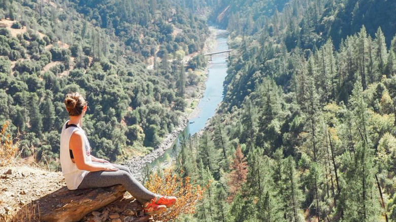
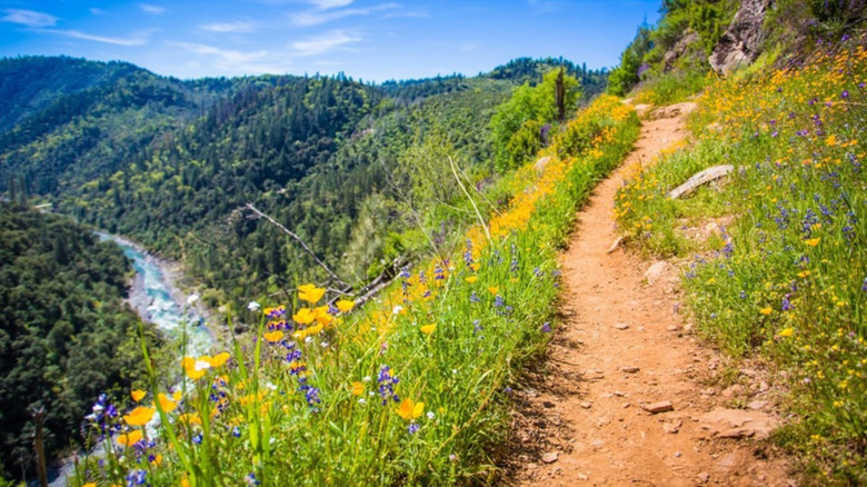
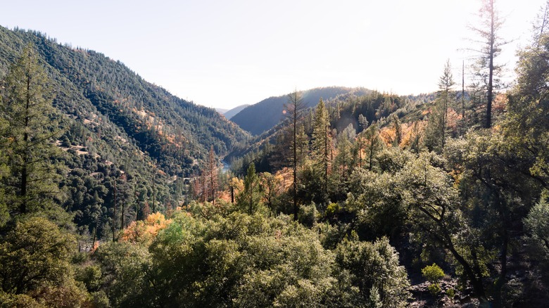
From high above the American River, you can gaze into a canyon that's rich with evergreens. The slow-moving water is a tinted blue-green, like liquid jade. In the warmer months, flowers bloom from the cliffs and the path is a copper-colored strip that hugs the hillside. According to the Bureau of Land Management, the 4.5-mile-long Stevens Trail snakes its way through the California outback, which looks barely changed since settlers first arrived in this part of the country.
Plenty of people come just for the view, but the trail has many other attractions as well: waterfalls, dips in the river, and authentic mineshafts, where prospectors once dug for gold. Note that the shafts aren't considered stable, so hikers shouldn't venture too far inside. The out-and-back trail terminates at the meeting point of the American River and the Secret Ravine, and the full hike should take about four hours in total. Definitely bring your best boots, as you'll be ascending 1,584 feet over the course of your journey.
If you're taking a road trip through California's national parks, Stevens Trail is a great place to escape crowds and learn some local history. Far from well-trod natural wonders like Yosemite and the Redwoods, this scenic walkway is a little-known nook. Indeed, the very existence of Stevens Trail is something of a miracle, given how long the path was abandoned.
The unlikely return to Stevens Trail
The trail was originally named after Truman A. Stevens, a local miner. However, the man who surveyed the trail was John Rutherford, a friend of Stevens', and the route was established as a toll path for men seeking gold. Use of the trail reached its zenith between 1870 and 1895, which was pretty late for the Gold Rush but still drew a good number of fortune-seekers. Miners burrowed into the cliffs, and the dark tunnels that resulted can still be seen today. It's likely that others waded into the American River to pan for gold as well. In some parts of this water system, you're actually still allowed to sift the river bottom in search of shiny nuggets.
After 1895, however, nobody had reason to come up here, and the neglected trail was clogged with vegetation and forgotten. It might have remained that way, if not for a Boy Scout who retraced the old path in 1969. Since then, the Bureau of Land Management has revived Stevens Trail and rigorously maintained it. The route has even been added to the Registry of Historic Places, a nice follow-up to the historic architecture and amazing food of the Old Sacramento Waterfront, about 70 minutes away.
Lodging, food, and other outdoor fun in the Colfax area
One caution about hiking here: While the canyon is forested, the trail itself doesn't offer much cover, and the dry heat can be deceptive. Prepare for this hike as you would for the desert –– with brimmed hats, lots of water, and layers of sunscreen. When you reach the river, consider splashing some water on yourself to keep cool.
The Stevens trailhead is located northeast of Sacramento. California's capital has its own international airport, or you could fly into San Francisco and drive about 2.5 hours. This quiet corner of California is part of the Sierra Nevadas and is a stone's throw from Tahoe State Forest. The nearby town of Colfax is located on Route 80, a popular road to take between Sacramento and Lake Tahoe. Colfax is a small town of 2,000 residents, but it's a great basecamp for exploring the region. Road-trippers will find a handful of restaurants, a Best Western, and the Colfax Motor Lodge.
Once you're done with the trail, you might set up a tent in one of the many campgrounds nearby. Or you may very well press on to Tahoe City, just 70 minutes farther down the highway. Lake Tahoe is a favorite destination for outdoors enthusiasts, in any season of the year. If you've never been there before, here are 12 tips for planning a trip to Lake Tahoe.