A San Francisco Hike Is A Local-Loved Round Trip Trail With The Best Views In The Bay Area
With its vibrant culture, iconic landmarks, and historical character, the San Francisco Bay Area is consistently one of the more popular tourist destinations in California and the West Coast. The Golden Gate Bridge, for example, is one of the most famous feats of engineering in the world, and notable San Francisco neighborhoods like Fisherman's Wharf, the Castro District, and Haight-Ashbury have their own distinctive character that draws countless visitors each year. Plus, with so many family-friendly activities across San Francisco, the city and surrounding Bay Area have something to offer visitors of all ages.
But for all the accolades given to its urban spots, the Bay Area also sits next to some of California's best outdoor destinations. San Francisco's Golden Gate National Recreation Area is one of the most popular parks in America's National Park System. Similarly, the Muir Woods National Monument in nearby Marin County lets visitors venture into a pristine forest of giant redwood trees that can make anyone forget about the major city just a few miles away.
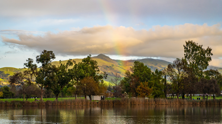
One of the best outdoor destinations in the vicinity of the San Francisco Bay Area is the beautiful, but manageable, Mission Peak. Located in the city of Fremont in the Bay Area's East Bay region, Mission Peak provides a thrilling mountain escape that is still within reach of most visitors. With both developed infrastructure and spectacular views of the Bay Area, Mission Peak's excellent trails offer some of the most beloved hikes anywhere near San Francisco.
Mission Peak and its surrounding mountain preserve is a splash of natural beauty right next to the Bay Area
Mission Peak is part of a larger mountain ridge, which in turn is part of California's epic coast ranges that stretch both north and south of the Bay Area. Mission Peak itself is not actually the highest peak on this particular mountain ridge, as the adjacent Mount Allison and Monument Peak are even higher. But Mission Peak does have the distinction of being both the most prominent and most accessible individual peak in the area. And at 2,517 feet high, the peak is more than tall enough to provide spectacular views for hikers.
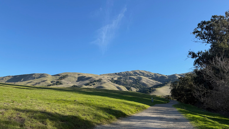
What's great about Mission Peak is that its various hiking trails provide a good range of challenges for different types of hikers. Summit routes like the main Mission Peak from Ohlone College Trail, the Mission Peak Loop, and the Peak Meadow Trail are all relatively difficult and strenuous hikes up the mountain's full elevation. But the Mission Peak Regional Preserve park also offers less challenging hiking routes for anyone looking for a more leisurely stroll along the mountainside, while still providing exceptional views!
With such a diversity of trails and incredible scenery on all sides, Mission Peak ranks among the top of the best East Bay hiking destinations. You can even sign up for educational interpretive hikes led by naturalists from the nearby Coyote Hills Regional Park. And if you're feeling up for an even greater hiking challenge, you can also continue into the adjacent Ohlone Wilderness Regional Park for a lengthier and more immersive experience of the scenic landscape of the East Bay.
How to have the best Mission Peak adventure, no matter your comfort zone
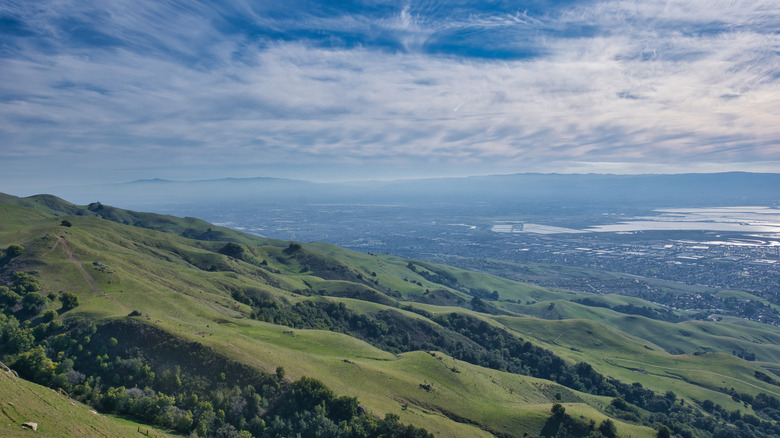
If you want to go to Mission Peak's summit, most routes are only around 6 miles one way (though you'll encounter many steep climbs in a relatively short distance). Notably, the mountainside has few trees, so direct sunlight may be an issue on hotter days. But even without a thick forest cover, the summit route does provide enchanting views of deep green grasslands and abundant wildflowers. Once you get to the summit, your effort will be rewarded with a breathtaking, 360-degree view that includes the cities of San Francisco and San Jose, Mount Tamalpais, the Santa Cruz Mountains, and, on clearer days, even the towering Sierra Nevadas in the east. And no trip to the Mission Peak summit would be complete without a selfie next to the famous Mission Peak pole (assuming it hasn't been vandalized).
Despite its prominent profile and natural beauty, Mission Peak is reasonably accessible by car. Mission Peak Regional Preserve is about 50 miles from downtown San Francisco, with a road trip usually taking a little over an hour (depending on traffic). Most visitors arriving by car will either park at the Mission Peak staging area in Fremont or the parking lot at the nearby Ohlone College. The mountain's hiking trails are free to enter, though the trails in the Ohlone Wilderness Regional Preserve require a $2 permit per person. Visitors arriving by car should also be aware that parking at Ohlone College will incur a $4 fee. Convenient parking options combined with the mountain's spectacular views make Mission Peak both an excellent San Francisco day trip destination, and a top stop on an ultimate road trip across the entire West Coast.