Channel Your Inner Mountain Goat On The 5 Steepest Dayhikes In America
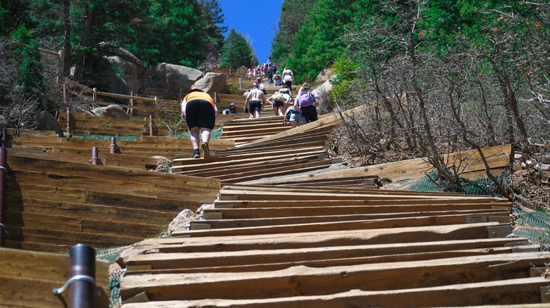
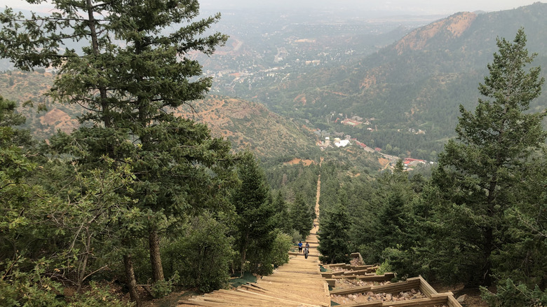
Think you're fit enough to bang out over 5,000 feet of elevation gain in a single day? How about 10,000? If so, then these five thigh-burning, soul-crushing, endorphin-boosting dayhikes are made for your bucket list. How hard are they? Let's just say that at least one veteran hiker recommends summiting Mt. Whitney, the tallest peak in the Continental U.S., as practice before attempting the infamous and dangerous Cactus to Cloud trail. And even then, you might not be ready. Some are marathons, but others are sprints. The shortest hike on this list, the Manitou Incline (pictured), offers up just 1 mile of torture, but it's one that regularly humbles the Olympic athletes who train on it.
All of these hikes fall squarely into the category of "type two fun." Type one fun is the kind you have visiting Rick Steves' favorite neighborhood in Paris. Everybody loves type one fun, more commonly known simply as: fun. Only a select few travelers seek out type two fun, which involves pain and suffering in the moment, but yields the kind of ecstatic, awe-filled peak experiences that once-in-a-lifetime memories are made of. Bear in mind that type two fun is of necessity hard-won, and these trails should be approached with a healthy dose of sober caution. Hiking any of these is a bit like shopping on Rodeo Drive in Beverly Hills, where the rule of thumb is, "If you have to ask the price, you can't afford it." In this case, the rule might be, "If you have to ask if you're fit enough to hike it, you aren't."
Mount Saint Helens
In 1980, Washington's Mount Saint Helens blew her top. The 9,677-foot tall mountain in the Cascade Range erupted spectacularly, spewing steam, ash, and hot mud. By the time the dust settled, Saint Helens was 1,300 feet shorter, with a crater where its snow-tipped, craggy peak one kissed the sky. So you may want to think twice before taking on this volcanic hiking destination.
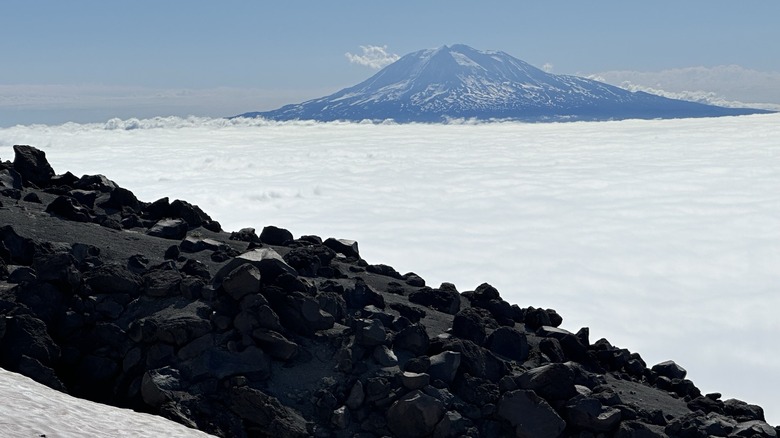
To climb to the top of the cinder cone, you'll gain 4,655 feet in a little over 4 miles, but these are some of the most arduous miles you'll ever hike. Starting early in the day, you'll play peek-a-boo with the mountain until you leave the treeline behind. Now the sufferfest begins. First, you'll pick your way through a boulder field (pictured), climb-crawling with your hands. There is no trail here. Instead, poles placed every few dozen feet indicate the general direction you need to climb. You'll frequently make false starts that take you to impassable spots and backtrack to better footing. This is where the 8.5-mile hike easily turns into a 12-mile hike. Did we mention that it's also steep?
Emerging from the boulder field, you'll cheer at the sight of the smooth footing ahead. You only have a mile to go to get to the summit from here. But that smooth slope is made of ash, and you'll slip backward with every step until your lungs sear with effort. Take breaks, and turn around to see Mount Rainier jutting out of the clouds, the king to Helen's queen. Once you finally reach the top there's a dramatic reveal that's totally worth it as you peer over the cornice of the crater to see steam burbling out of the ground a thousand feet below. It looks like Mordor from "Lord of the Rings." Don't get too close to the edge, Frodo!
Cactus to Clouds
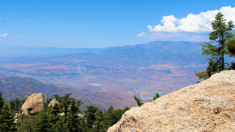
The conditions on this hike near Palm Springs, California, are highly unusual, and timing is everything. On any given day it can easily be 100 degrees at the bottom and snowing at the top. This trail is vanishingly long at 20.3 miles, and you'll climb over 10,000 feet. That last zero is not a typo. But C2C, as it's not-so-fondly referred to, is definitely a dayhike, not a backpacking route, as hikers who have completed the route agree that it's so steep you would not be able to carry a full pack and enough water for two days.
Only hike here when temperatures hit the sweet spot in spring or fall. Experienced hikers can plan on hiking at around half of their usual pace. For most, that makes this a 10-16-hour long expedition. You'll start well before dawn, with a headlamp, at the trailhead in Palm Springs, at the base of the aerial tramway, which is how you'll descend. There is no water for the first 8 miles, until you reach the Round Valley Ranger Station. "I carried 6L and drank it all, refilled at the ranger station and drank another 4 the rest of the hike," one Redditor writes. 6 liters of water weighs 13 pounds, for the record.
Don't jump on this dangerous trail just because you read about it here on the internet, because people have died of heat stroke on this mountain doing just that. But if you train properly, this can be an epic hike that gives you an exhilarating sense of accomplishment, and the sweeping views of the Coachella Valley are simply stunning. A better way to see them is to take the tram up and make the 10 mile hike to the top and back.
Mount Borah
While 50,000 people climb Yosemite's Half Dome every year, just 3,000 to 5,000 attempt to bag Idaho's highest peak, Mount Borah. The remote trail is a hefty four-hour drive from Boise. You'll want to get here the day before your hike, and sleep at the tiny, five site campground at the trailhead. Plan for doing this one in high summer, when you'll encounter minimal snow and ice — you'll soon learn why.
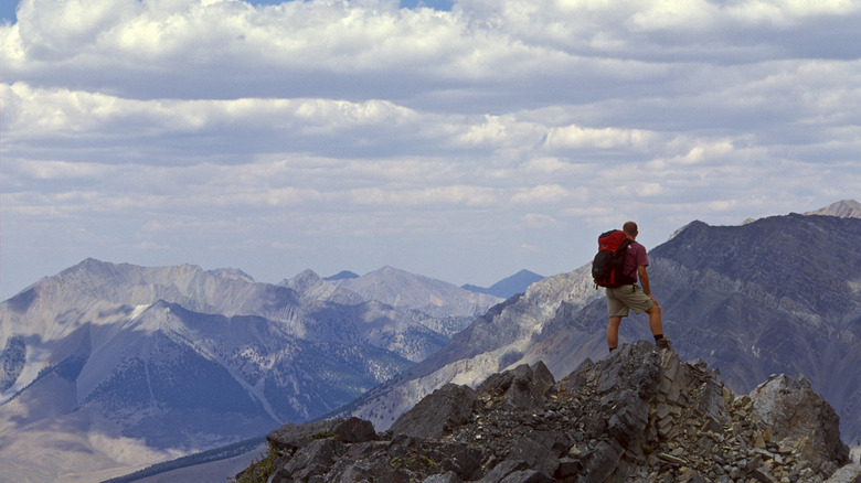
The majority of this 7.7 mile route is unforgivingly steep. After a mile or so approach, you'll be steadily, relentlessly gaining 5,000 feet in 4.5 miles. The trail is well-maintained and clearly marked, but if you're used to ambling up easy switchbacks, you're in for a rude shock here. This trail doesn't mess around, but heads straight up. Near the top you'll reach a 100-yard stretch dubbed Chicken Out Ridge, where you'll need to scramble on all fours. This is the place where you'll be glad to see a clear path forward with no snow.
Here, the physical challenge gives way to a mental challenge. With drop-offs on either side, it gives climbers with a fear of heights pause, but veteran hikers report that it's quite doable if you stay high. "Chicken out ridge is an absolute blast, and the summit stretch after it is hard as hell. Views for days," one AllTrails user reports. If you fancy having a mountain summit and miles and miles of peaks as far as the eye can see all to yourself, you may just get your wish on top of Mount Borah. That's reason enough not to chicken out. When you come down, your tired, trembling muscles will be ready to seek out one of Idaho's 200 natural hot springs. That's a stellar way to balance out the risk-to-reward ratio.
Manitou Incline
Athletes at the Olympic Training Center in outdoorsy Colorado Springs regularly use the Manitou Incline to build their endurance chops, and they consistently report that it kicks their glutes. And thighs. And quads. Unlike the other trails on this list, this one is actually a set of stairs, where an old cable car line once ran, used to transport building materials up Pike's Peak before there was a road. When the rail line was removed, the remaining railroad ties formed an ersatz "stairway."
This hike is short and not-so-sweet. It goes straight up the flank of Colorado's Pike's Peak. No switchbacks. No mercy. The 2,768 steps that climb 2,000 feet in under a mile are incredibly steep, with sections that reach a 68% incline. If you conquer the Incline, you can claim bragging rights forever. But take that with a dose of humility, as you won't be alone: Around a quarter million people hike this route every year, which is the reason you'll need to reserve a free permit, park in a distant lot, and take a shuttle to the trailhead.
If you're a mortal, rather than an Olympian, you'll probably take around three hours to hike the entire 4-mile loop. The stairs are one-way only (that's up), with a longer route down on the Barr Trail, with switchbacks. Should you find you've bitten off more than you can chew, there is a bail-out point mid-way up that will let you curtail your ascent, no harm no foul, no heart-attack. And if you get to the top and think you've got more gas in the tank, you can always continue on the Barr Trail to the top of Pike's Peak, to bag a 14er.
Half Dome
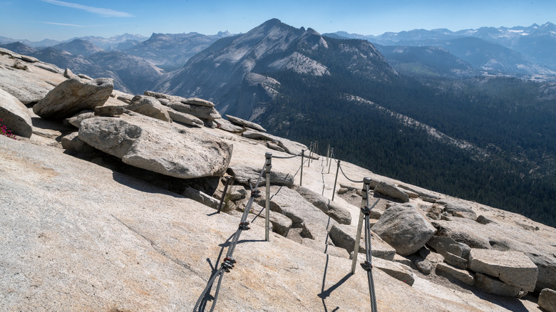
16 miles. Over 5,000 feet of elevation gain. Still, Yosemite's Half Dome is a lot harder than it sounds on paper. The final section is so steep, climbing up the dome's smooth egg-shaped granite flank, that a sturdy cable railing has been installed for climbers to cling to. And still, even experienced hikers do die on this route. Get caught in the rain, and that smooth granite becomes a slip 'n slide, where it's easy to plunge to one's death.
This hike begins along the famed John Muir Trail, which also comprises one of the most scenic segments of the Pacific Crest Trail. Most of your mileage will be hard but not dangerous, with a series of scenic reveals: Vernal Falls, Nevada Falls, then the valley floor stretched out below you, paradise found. Feel free to chicken out on the last 400 feet, which is where the steep and dangerous part of this hike takes you to the top of Half Dome, usually amid a conjested crowd of other hikers who happened to win the permit lottery for that day.
Skip the cable section, and you don't need a permit at all. Our advice is to give Half Dome a pass and instead hike to Cloud's Rest, an excursion that's plenty rigorous and yields views of Half Dome (pictured), that will have your spine tingling with awe. For an even easier option, head up Glacier Pass and stroll 2.2 miles to underrated Sentinel Dome, mile-per-mile one of the most scenic routes in all of Yosemite.
Our methodology
We scoured blogs and social media for hikes veteran outdoorspeople consider especially hard or steep. To stick to the definition of a dayhike, we ruled out climbs that require technical mountaineering skills, but not those that may require a bit of scrambling to reach a summit. It isn't always about total elevation gain — a long, shallow ascent doesn't cause the same kind of thigh burn a short steep one does. The hike up the Barr Trail to Pike's peak didn't make the cut, because while the hike features a lot of elevation gain, it's not particularly steep due to being so long. But the shorter, crueler Manitou Incline? Oh yeah, that one counts.
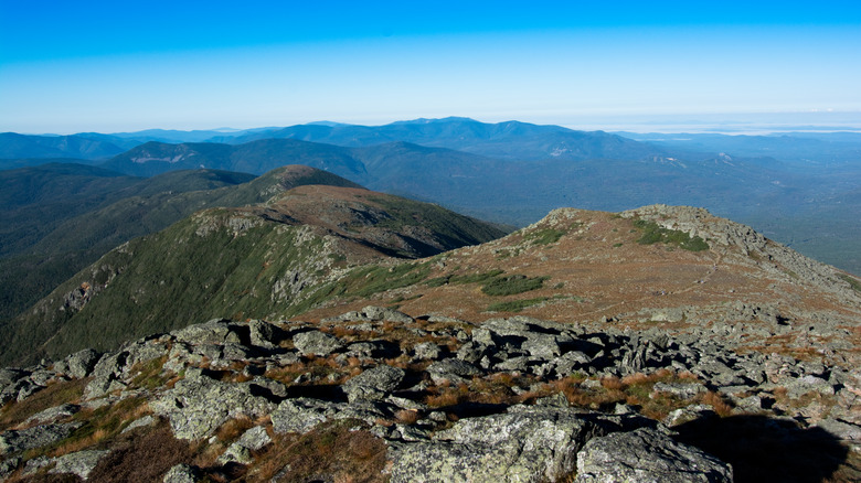
We also ruled out hikes that should really be done as a backpacking trip. That's why you won't find the 22-mile hike up and down Mount Whitney on this list. Climbing the highest peak in the Continental U.S. requires no special technical skills, but it's traditionally an overnight. The same goes for the Presidential Traverse in New Hampshire's White Mountains, a 19-mile hike that hits a series of 13 peaks (pictured), and the Kalaulau Trail in Hawaii. These are best tackled with a tent.
We also left off the Grand Canyon Rim-to-Rim hike. Although it is increasingly popular as a dayhike, National Park Service rangers sincerely wish foolhardy hikers would stop attempting it, so that they can stop sending helicopters into the canyon to rescue them — 300 in a typical year. Listen to the rangers. The Grand Canyon R2R is too long, too hot, and too hard to hike in one day.
