The 5 Easiest Colorado Mountain Peaks To Bag Your First 14er
We may receive a commission on purchases made from links.
Mountaineers have a nickname for the tallest mountains in the U.S., calling any peak over 14,000 feet a "14er." Washington has four, Alaska seven. California has 12, including the highest in the continental U.S., Mount Whitney, but Colorado bests them all with 58. It's a dream of many hikers to bag at least one of the Centennial State's highest peaks, and the good news is that it's entirely doable — which is not the same as easy. The starting elevation alone means that you'll be taxing your body to reach the summit, and most peaks require some amount of scrambling in the final stretch.
Still, many Colorado 14ers aren't technically difficult and can be conquered by any reasonably fit, persistent, and prudent hiker. Over 70% of the 58 named peaks are rated as Class 1 or 2 (of 5). A Class 1 hike means you can walk upright along a defined trail. Class 2 means you might have to scramble over some talus or scree, using your hands to steady yourself, but don't need special equipment and aren't in danger from any real height exposure. In case you're curious, Class 5 is what you know as rock climbing, where gear and training are essential.
We've omitted peaks with trailheads that require a 4x4 to reach. Each of the hikes below offers a different flavor of experience, so you can choose your own adventure. If you just want to clock a 360 degree view without hiking at all, then drive to the top of Pike's Peak, aka "America's mountain," where you can sample the air at 14,115 feet from a sleek, modern visitors' center, with coffee and a delicious donut. But if getting there on your own steam is half the fun you're after, then read on.
Mount Bierstadt
The trailhead that leads to Mount Bierstadt happens to be located on one of Colorado's most unbelievably gorgeous drives, the Guanella Scenic Byway. The well-groomed and easy to follow pathway makes this trail popular with sunrise-seekers, who camp at the trailhead and rise before dawn. At around 4 a.m., you'll see a line of headlamps snaking up the trail. Join them, and you can time your ascent so there's just enough light seeping over the horizon to navigate the boulders at the top. You should reach the summit just as the sun breaks out to gild the granite peaks as the sky brightens from navy, to cobalt, to robin's egg blue.
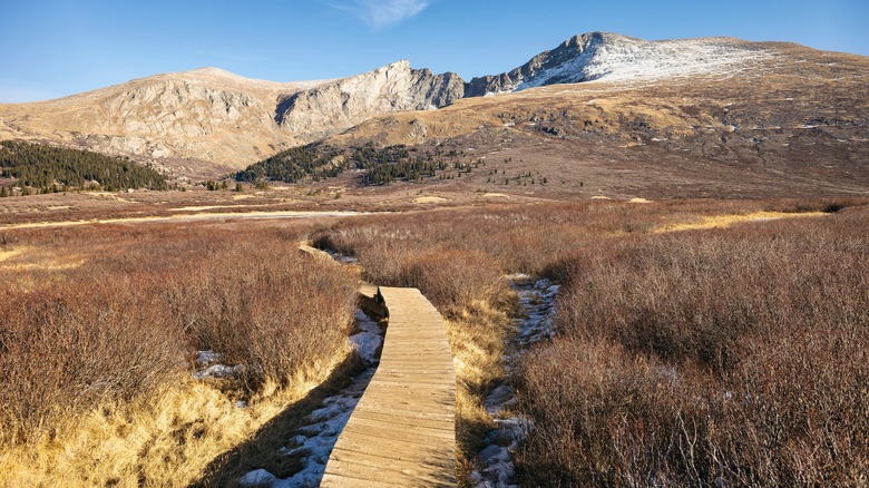
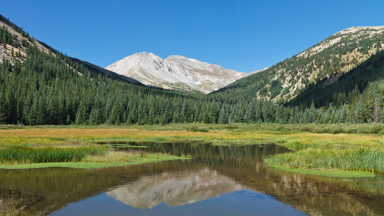
You'll gain 2,700 feet in 3.6 miles on your way to the summit, for a 7.2-mile round trip that should take you around four hours. As you set out, you'll wander a broad, packed path and sections of tidy boardwalk through low-standing willow shrubs (pictured). Stay on the trail here, as it's deceptively muddy and swampy in this section. Higher up, you'll emerge onto solid ground and come to a series of switchbacks, then you'll have a traverse along a shallow ridge to the summit. The final 250 feet of elevation gain take you off trail for a Class 2 climb up a talus and boulder field.
If you're hiking solo, or new to hiking at altitude, the lack of solitude on Bierstadt can be a plus. There's safety in numbers, and you'll never be alone on this wildly popular route. "Bierstadt is far and away the best 14er for a beginner," one Redditor says. "Anyone who says otherwise is most likely an 'expert' and has completely forgotten what it was like doing their first 14er. A crowded trail is good for a first timer."
Mount Elbert
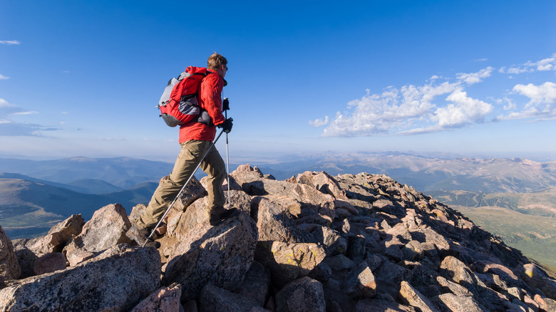
Mount Elbert's nickname is "the gentle giant," because it's an easier ascent than it's height would have you believe. At 14,433 feet, this is the tallest of the Colorado 14ers, and the second highest summit in the continental U.S., after California's Mount Whitney. You'll be ascending via the north route, which begins near the Elbert Creek campground. Overnighting here to get an early start is an excellent strategy. You'll be climbing 4,400 feet over 4.7 miles, and don't be surprised if you clock 10 miles or more round-trip as you wander a bit to take in the views, but what makes this one relatively easy is the excellent quality of the trail. Before you emerge from the treeline around mile 3, you'll spend about a mile on a section of the Continental Divide Trail, so expect to see some shaggy thru-hikers.
Mount Elbert presents one particular challenge that's entirely mental in nature: On the way to the top you'll encounter three false summits. What's a false summit? That's when the angle of your ascent creates the optical illusion that you're "almost there" by presenting a hump in the ridge as if there were nothing beyond it but blue sky. You huff and puff your way up to this peak, fully expecting triumph and joy, only to feel crushed when you finally arrive to see yet another ridge, leading to yet another summit. And so on. Psych!
You might find snow on the ground near the summit most times of the year, so bring along some traction cleats — we like the ones by Yaktrax. Once you reach this mountain's true summit, the heady cocktail of adrenaline, endorphins, and sweeping views from the highest point in the Rockies will have you swooning in ecstasy.
Quandary Peak
This mountain trail near the charming alpine town of Alma is wildly popular — with wildlife as well as humans. This well-loved mountain even has its own website, climbquandary.com, which you'll need to visit to make a parking and trailhead shuttle reservation in peak season. If you visit in the shoulder season, you'll avoid the crowds and be able to park right at the trailhead. Quandary Peak is so popular because this is a solid Class 1 14er where you can walk right up to the top, without so much as a scramble on the final approach to the summit. If this is important to you, you've found your mountain. At just 6.3 miles, with 3,300 feet of elevation gain, you won't even have to set out in darkness in order to summit and be back down before the afternoon thunderclouds roll in. Like Mount Bierstadt, the trail's popularity might be reassuring for first-timers hiking solo.
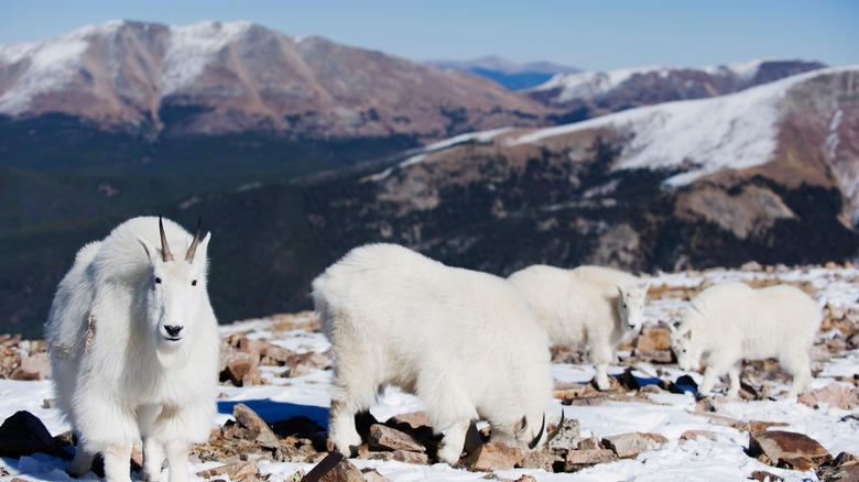
Quandary Peak is also popular for its stupendous summit views. As the only 14er in the Tenmile Range, it stands shoulders above the surrounding peaks and ridges, so you will be treated to snowy, sweeping views for miles around. The wind will whip and howl, but that doesn't bother the mountain goats in their shaggy white coats, who hang around above the treeline, and can be quite curious about you.
The same shuttle takes you to a second trailhead, that for McCollough Gulch, which is also worth exploring. But be prepared: If a 3.6 mile hike to alpine lakes and waterfalls sounds easy, this is the harder of the two excursions. By the time you reach the second lake, you might be wishing you'd climbed a mountain instead. But people who finish this hike declare it to be an all-time favorite.
Mount Yale
Mount Yale, in the Collegiate Mountain Wilderness 12 miles outside the town of Buena Vista, is a delightful, family-friendly gem, perfect for introducing older children or teenagers to peak bagging. That's because there's so much more to this one than just a summit slog. You'll stroll through forests, and fields of wildflowers in summer, rising steadily toward the treeline and ever more stunning views. The trail is long, but not technical, with only the last few hundred feet requiring you to strap your poles to your daypack to free up your hands for bouldering. (If it's chilly, this is a good time to whip out a pair of gloves.)
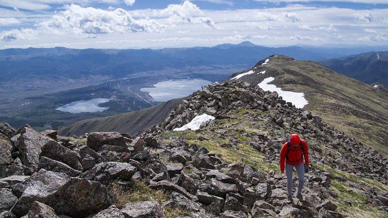
The road is paved all the way to the trailhead — a plus if you're on an epic Colorado road trip in a rental car, because some contracts prohibit driving on dirt roads. A lot of mountains in the Colorado Rockies are peaks linked by high ridges, so that they tend to blend together along the horizon. But Mount Yale's rugged prominence, soaring up out of the surrounded forested terrain (pictured), means that you really appreciate the mountain's 14,196 feet as you approach it.
The length of this one means you should climb out of your sleeping bag before dawn, to be off the summit before noon. Another good reason to get that early start? More time to soak your burning quads and hamstrings in the stunning natural creekside at Princeton Hot Springs, just 26 miles downhill from the trailhead. Just grab a day pass, and find your Goldilocks temperature among a series of cascading natural pools as the hot springs water mixes with the ice cold flowing creek. After a long, hot, therapeutic soak you'll be ready to tackle another peak tomorrow.
Handies Peak
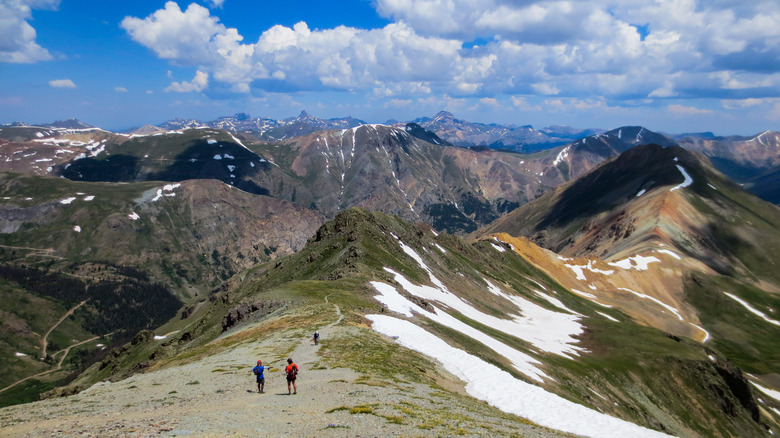
At 5.75 miles and 2,500 feet of elevation gain, Handies Peak, the highest in the San Juan Mountains, near the scenic Million Dollar Highway, looks like a walk in the park. And while you're traversing the green American Basin on your way to the summit, it'll feel like one. There is one catch, however: You'll need to add 2 miles to the total distance if you don't have an all-wheel-drive vehicle. Even so, this Class 1 trail is an easy to access beauty. As a bonus, if you crave solitude in nature, Handies is less crowded than some of the other trails on this list.
This trek has two highlights: the basin and the summit. From the true trailhead, you'll enter the high mountain meadow of the American Basin, a big bowl full of wildflowers in summertime, with a pretty creek threading through it. Earlier or later in the year, persistent snowfields can make for some fun "glissading" on your descent. That's the term for sliding down snow, on your feet or on your bum. If you prefer to sit, bring some slick rain pants that you don't mind ruining, or even a trash bag.
Leaving the basin, you'll climb a series of switchbacks leading to a ridgeline, then another series of switchbacks to the top. There, you can turn a full 360-degrees and not see a single trace of human habitation. It's remarkable. Not all summit routes are good choices if you hike with dogs, due to rough surfaces that can lacerate their paws, but this is one of the few Fido-friendly 14ers due to smooth, packed trail surfaces.
Our Methodology
To determine which 14ers qualified as "easiest" for a first-timer, we took into account several factors: First, how difficult is it to get to is the trailhead? Some great beginner mountains require a 4x4 with high clearance to get to, so we nixed those. Second, how easy is the trail to navigate? By definition, beginner-friendly means no advanced route-finding skills should be necessary. Then there's technical difficulty. A little scrambling near the summit is to be expected on most — but by no means all — of these ascents. But the trail should never feel dangerous.
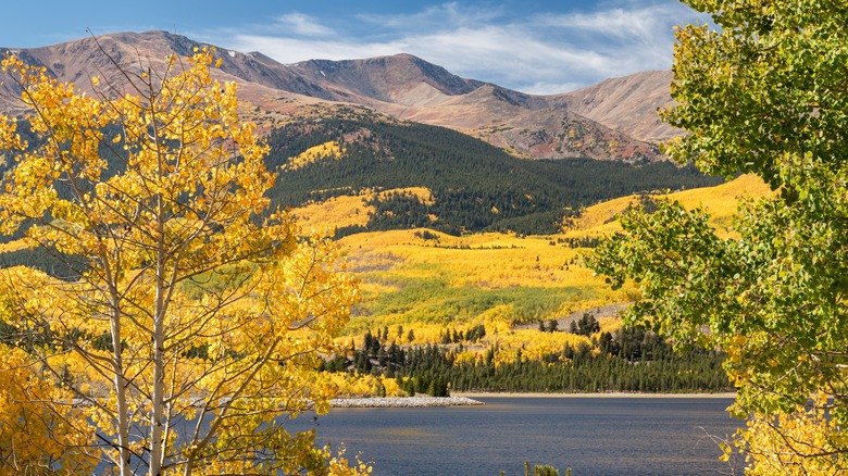
With our criteria in place, we set out to find hikes that exemplified particular summit goals. What to hike with teenagers? With a dog? Are you looking for solitude on the trail, or are you a solo hiker who prefers safety in numbers on a popular route? Want bragging rights for climbing the highest mountain in Colorado? (Mount Elbert, pictured.) There's something on this list for all of you. As for sourcing, we scoured popular sites like Reddit, AllTrails, and Tripadvisor, but also consulted blogs and expert forums like summitpost.org and 14ers.com. So get out there, get acclimated, and get started! Just remember that peaks are a lot like potato chips: Bet you can't bag just one.
