The Most Beautiful Hikes In Oregon, According To Hikers
Oregon is consistently ranked as one of America's best states for hiking, and it doesn't take long to see why. The Beaver State is covered in mountains, forests, waterfalls, and cozies up next to a gleaming ocean. Quite often, these features overlap, and it's not unusual to hike up a forested mountain and pass several waterfalls before you're rewarded with sweeping coastal views on top. In this greenest of states, deciding between the prettiest hikes sometimes felt as strenuous as making it to the summit of Mt. Hood.
Aside from Crater Lake and Trillium Lake, our hikes fall into two categories: Waterfall hikes and beach hikes. With lots of rain and mountainous terrain, the state has at least 238 known waterfalls, one of the highest numbers of any state in the country, and many trails pass through several. As we head out of the forests, we arrive at its shimmering coast, which is unique not only for its staggering beauty, but also because it is arguably the most hikeable coast anywhere in the U.S. By law, Oregon's entire 362-mile "People's Coast" is open to the public, and the Oregon Coast Trail passes through all of it. So grab your boots and best waterproof gear, and prepare to waterfall in love.
Natural Bridges to Arch Rock State Park
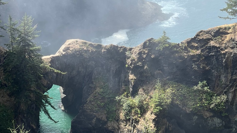
Oregon's southern coast is a scenic wonder of evergreen forests kissing a misty, pristine ocean dotted with geologically fascinating sea stacks and arches. To catch some of Mother Nature's most brilliant works of art, drive along the Samuel H. Boardman State Scenic Corridor, a 12-mile-long stretch along Oregon's southernmost coast. The Oregon Coast Trail runs through the corridor, so if you have a few days, we highly recommend walking the entire length.
If you want to witness some of the most striking sea stacks, we recommend three trails that span from the Natural Bridges — seven stunning arches that are one of the most recognized attractions of the Boardman Scenic Corridor — to Arch Rock State Park, which overlooks a perfectly arched 50-foot rock in the middle of the ocean. To see the Natural Bridges, drive along the Oregon Coast Highway until you see signs for the parking lot. The viewpoint is just a 50-foot walk from the parking lot, and since the 0.6-mile trail along a narrow, high cliff can be dangerous, many are content to enjoy the Natural Bridges from the viewpoint.
Amble just a few minutes north to the Secret Beach Trail, which is marked as the Thunder Rock Cove Viewpoint. Walk for roughly 1.6 miles along a creek running through fern-strewn forest until you reach the beautifully hidden Secret Beach, where you can sit along a quiet, sandy beach next to a roaring waterfall and marvel at four massive sea stacks. To get to Arch Rock State Park, either walk 15 minutes along the road to the trailhead viewpoint or walk 2.3 more miles along a forest trail.
Cleetwood Cove Trail, Crater Lake National Park
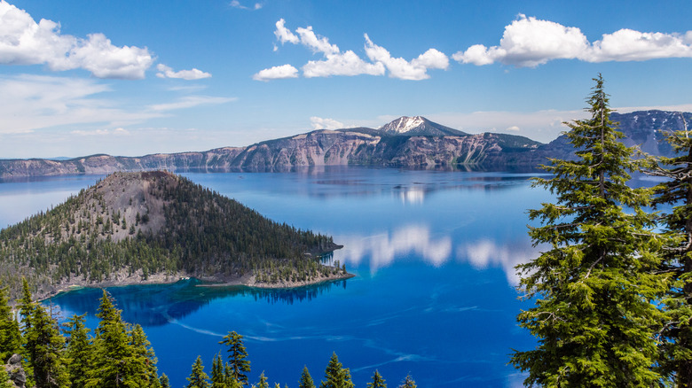
Oregon is full of creeks, rivers, and waterfalls that eventually flow into its stunning Pacific Coast. But one lake stands completely alone, and as a result, it is considered the clearest, cleanest lake in the entire world. It perfectly reflects the sky and glows a piercing blue that draws in hundreds of thousands of visitors from around the world each year.
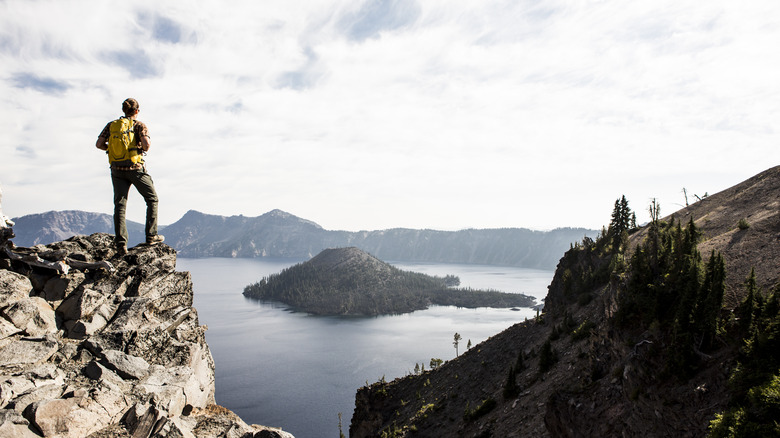
If you haven't already guessed, we're talking about Crater Lake, the 20-square-mile lake that gives its name to Oregon's only national park. As its name suggests, it is a literal crater created when a 12,000-foot volcano erupted and collapsed about 2,000 feet. Over the millennia, the crater filled with rain until it became the deepest lake in the United States and the eighth deepest in the world.
Anyone who wants to reach those fantastically blue waters will need to work for it. The Cleetwood Cove Trail is the only legal access to the water, where swimming, wading, and fishing are permitted in select areas during the summer months. The trail descends about 700 feet in just over a mile. The way down will be wonderful — hikers will enjoy panoramic lake views under the shade of large trees. When you finally get to the water, try diving into the bracingly chilly water, which might help alleviate the pain of the steep hike back up. If you'd like an easier trail, the Discovery Point Trail is a 2.1-mile hike above the lake, providing panoramic views of the lake and Wizard Island in the middle. In the winter, it's a prime spot for snowshoeing. The Watchman Peak Trail is another leisurely trail for great lake views, while the Plaikni Falls Trail takes you through beautiful woods to a waterfall.
Saint Perpetua Trail, Siuslaw National Forest
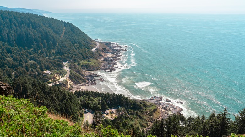
When a viewpoint is described as one of the most beautiful on the Oregon coast, itself lauded as one of the most beautiful in the country, it's well worth a trip. Midway through the coast, the Cape Perpetua Overlook towers 800 feet above the waters, providing panoramic views for miles and miles of lush, mountainous temperate rainforest and the creamy blue ocean crashing into it. It's the sort of rare view that makes you acutely aware of how lucky we are to live on Planet Earth.
There are a few ways to get to this vaunted viewpoint, which are all part of the larger Cape Perpetua Scenic Area. The Saint Perpetua Trail starts at the Cape Perpetua Visitor Center and winds 2.8 miles through dense forest until you reach the overlook, which is crowned by an evocative stone arch crafted by the Civilian Conservation Corps in the Great Depression and was later used as a Coast Guard lookout during World War II.
For a shorter trip, drive up the Cape Perpetua Lookout road, then take a short walk from the parking lot along the Whispering Spruce Trail. For a longer walk through 5.7 miles of forest, take Amanda's Trail. While you're in the neighborhood, be sure to visit Thor's Well, a sinkhole carved into basalt known as the "drainpipe of the Pacific," and the Devil's Cauldron, a narrow inlet within the basalt shoreline that results in thunderous waves.
Trail of Ten Falls, Silver Falls State Park
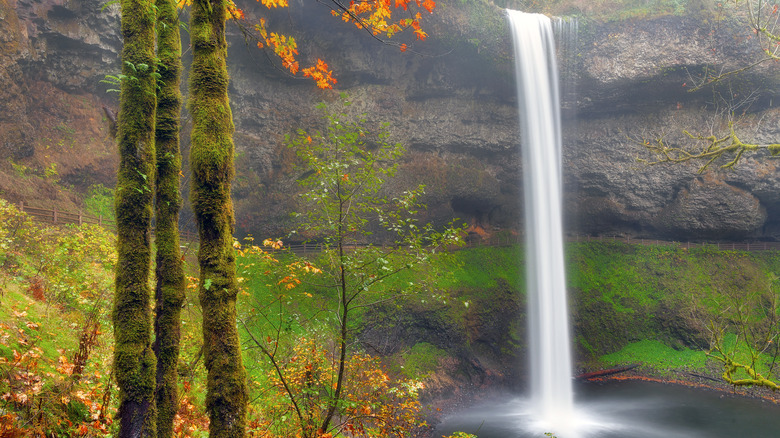
Forget Oregon — this enchanting walk along a rocky, forested canyon through ten different soaring waterfalls may be one of the most beautiful hikes in the entire world. About an hour south of Portland lies the incredible Silver Falls State Park, often called the "Crown Jewel of Oregon State Parks." As soon as you step into the lush, misty forest and hear the roar of the first waterfall, you'll understand exactly why. The most common route through the crown jewel begins at the large South Falls parking lot and loops clockwise for 7.8 miles. In one moderate hike, you'll experience many of the Pacific Northwest's most enchanting waterfalls.
Not long after you embark, you'll be treated to the trail's most famous, fantastic waterfall, the 177-foot South Falls, which tumble dramatically off a rocky overhang, over a canyon of bright green moss, and into a flowing creek below. As if this weren't special enough, visitors can actually walk comfortably along a well-marked, paved trail directly behind South Falls. You'll enjoy this same rarefied, life-changing luxury at the 93-foot Lower South Falls, the 106-foot Middle North Falls, and the 136-foot North Falls. In each instance, you'll get quite close to the falls, so make sure to wear water-resistant clothing.
Other notable falls along the trail include Twin Falls, where several streams of water flow nimbly over and around several artfully arranged rocks along a wide ledge; Drake Falls, which flow gracefully down a 27-foot canyon in the middle of a dreamy green forest canopy; and Lower North Falls, which also add a dramatic dash of white in the middle of an ocean of glorious green.
Trillium Lake Loop, Mt. Hood National Forest
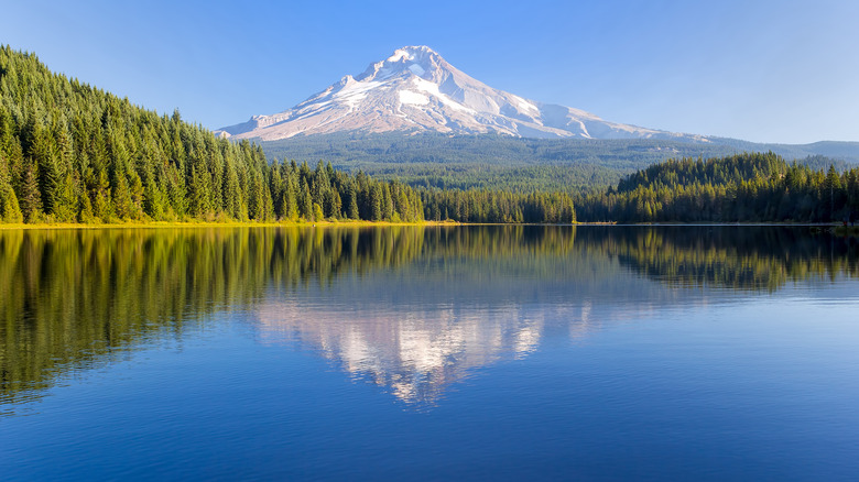
The beautiful snow-capped peak of Mt. Hood is visible all over the Portland area, though from far away, it can often be mistaken for a cloud. At the deep blue waters of Trillium Lake, you won't only get a clear view of this magnificent mountain: you'll get to see it twice. Along this gentle, flat, 2-mile trail, you'll be able to gape at the majesty of an 11,245-foot volcano reflecting perfectly into the calm waters of this lake, enhanced by the dense surrounding evergreen forest. There are many different hikes with majestic Mt. Hood views, but a leisurely stroll around a pristine lake with near-perfect mountain views throughout will surely appeal to just about anyone.
The appeal goes well beyond hiking. As a 63-acre lake, Trillium has a sandy beach great for swimming. It also has a fishing pier and a boat launch and is popular for canoeing and kayaking, but no motorboats are allowed. Nearby, the Trillium Lake Day Use Area provides a nice, shaded spot for a picnic, as well as an amphitheater that can accommodate up to 30 people, which has been used for weddings. If you'd like to spend a night by the lake and mountain, the Trillium Lake Campground offers dozens of single and double sites for tent and RV camping. Each camping site comes equipped with a table, campfire ring, and a grill.
The fun isn't just limited to the warmer months. In the winter, the roads nearby are groomed for snowshoeing and cross-country skiing, and there is a great area for sledding at the southeastern edge of the parking lot. This is one of the most fun ski destinations on the West Coast.
Ramona Falls Trail, Mt. Hood National Forest
There are few sites worth fording a river for, but the ravishing Ramona Falls inspire thousands of people to do it every year. About 20 miles northwest of Trillium Lake along the slopes of Mt. Hood, the Ramona Falls Trail leads hikers through about 7 miles of lush pine forests, wildflowers, and occasional mountain views. It is spectacular.
It's all a literal walk in the park until you reach the Sandy River, a fast-flowing river in the middle of the trail. There were once bridges over the river, but they kept getting destroyed in flash floods, and the Forest Service decided it was no longer worth the effort. Today, hikers can cross a series of makeshift logs, but it's important to do it as safely as possible. Check the weather beforehand, and don't hike if it's raining. Don't attempt a crossing if the water is high or flowing too quickly.
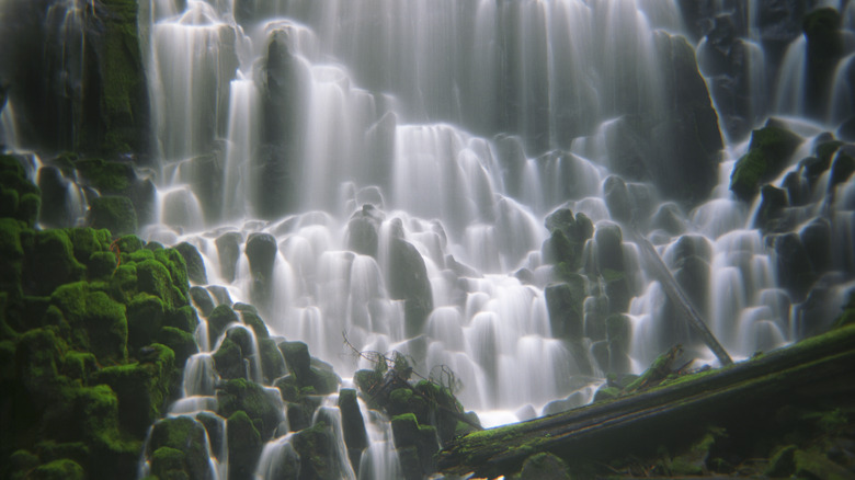
It is best to attempt the crossing during the morning from mid-summer to early fall after the snow has melted entirely and water levels are at their lowest. Bring trekking poles and waterproof shoes, and unclip your waist belt before you attempt the crossing. And perhaps most importantly, never go alone. Check here for more tips from the Forest Service on how to cross Mt. Hood's many glacial streams. If you make it across — and you most likely will — you'll be rewarded with views of the incomparable Ramona Falls, which cascade dramatically down a 120-foot granite wall at the base of Mt. Hood. The wide wall is full of jags and crags, and the water almost looks like a bolt of white lightning as it wends and weaves through them all.
Eagle Creek Trail, Mt. Hood National Forest
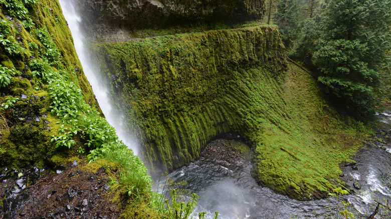
Imagine the Trail of Ten Falls perched on a narrow forest ledge hundreds of feet high. That's basically what you'll find along the Eagle Creek Trail, another truly exceptional trail leading through a waterfall wonderland. The trail traverses nearly 13 miles along Eagle Creek and its tributaries atop a ledge blasted out of the cliffs. This exceptionally challenging project reaps rich rewards, allowing hikers to pass through eight exceptional waterfalls while on top of a towering rainforest canyon. There is no trail quite like it in the world, and even without the many waterfalls, it would still rank as one of Oregon's most beautiful. The waterfalls take it to another level. Standouts include Metlako Falls, which spouts out like a powerful fire hydrant stream from a gorge; Punch Bowl Falls, which flow into a large swimming hole; Tunnel Falls, which hikers can travel behind via an artificial tunnel; and Twister Falls, in which two opposing streams cross at the top, forming a white, watery X.
The trail is out and back, which would take nearly 26 miles. Luckily, the site boasts about 10 to 12 different campsites along the way. No matter how far you venture, make sure to bring a lightweight pack, trekking poles to help navigate the more challenging sections, and waterproof clothing — head to toe. This is the Pacific Northwest, also known as the "Wet Coast," and there's a lot of water along this route.
Multnomah-Wahkeena Loop, Columbia River Gorge National Scenic Area
Are you sick of waterfalls yet? Well too bad, because you're about to get six more, and one of them is a doozy. The popular Multnomah-Wahkeena Falls Loop is located in the heart of the Columbia River Gorge, an 80-mile canyon of the Columbia River that overflows with more than 77 waterfalls on the Oregon side of the river alone. This magical forest roaring with the sound of water is just 30 minutes east of Portland, so it's exceedingly popular.
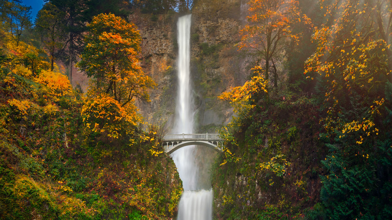
Nowhere will this be more evident than the traditional starting point of the hike, the incomparable, indescribable, iconic Multnomah Falls, which at 620 feet are the tallest in Oregon and the most visited natural recreation site in the Pacific Northwest. The falls are so large that they are broken into two different tiers, which contributes to its unique appeal. At the point where the upper half flattens out before flowing into the lower half, the iconic 1914 Benson Bridge curves elegantly across the canyon, giving hikers the chance to hover in the heart of the action.
After you cross the bridge, continue up to the trail until you reach a wooden observation deck at the top of the falls. The trail merges with the Wahkeena Trail, which travels through verdant forest along the Wahkeena Creek. Many switchbacks and smaller falls later, you'll arrive at the magical Fairy Falls, which almost resemble a fairy with long, flowing white hair made of a thousand lightning bolts. You'll pass along beautiful stone footbridges to Lemmons Viewpoint, where you can marvel at views of the Columbia River flowing through towering palisades. Nearby, you'll round out the trip by stopping along another antique bridge hovering over the dazzling, two-tiered Wahkeena Falls.
Elk Flats Trail, Oswald West State Park
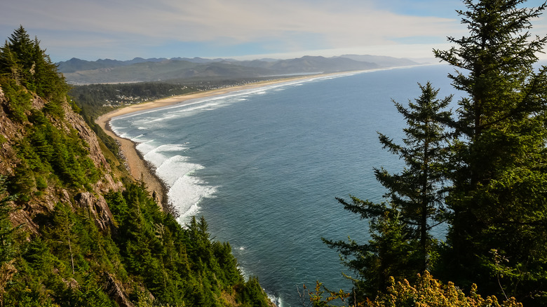
The waterfalls of the Columbia River Gorge eventually end up in the Columbia River, which flows into Oregon's breathtaking Pacific Coast. About an hour and 45 minutes northeast of Portland near the formidable Cape Falcon, the incredible Elk Flats Trail offers the perfect combination of ocean views, hidden beaches, towering cliffs and mountains, fecund forest, radiant wildflowers, and another diabolical whirlpool.
The 2.9-mile trail starts in a parking lot just off the Oregon Coast Highway, and the trail splits into two not long after the trailhead. If you take a left, you'll walk down through a lush meadow bursting with wildflowers until you arrive at a gorgeous promontory offering panoramic views of the ocean, the cliffs of Neahkahnie Mountain, and Cape Falcon. Take a right from the fork, and you'll walk through more floral meadows and forest to a ledge overlooking the Devil's Cauldron, another narrow inlet where powerful ocean swells crash dramatically into rocky cliffs.
If you're feeling vigorous and want even more incredible views, you can hike 1,683 feet up nearby Neahkahnie Mountain, where the summit rewards hikers with miles of epic coastline views. To get to the top, you can either scoot across the highway from the Elk Flats trailhead (where you'll take the challenging North Neahkahnie Trail) or you can drive about 1.3 miles south to take the gentler South Neahkahnie Trail. If you're looking for another nearby hike with the perfect combination of ocean, forest, and meadow, head to the nearby Cape Falcon Trail.
Crescent Beach Trail, Ecola State Park
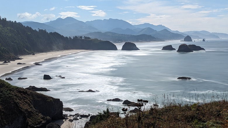
There aren't too many beaches in the world with elk tracks on the sand. We end our journey in spectacular fashion at Crescent Beach on Oregon's northern coast, a secluded beach where the only sounds are the crashing of waves against sea stacks and the barking of seals and sea lions in the distance. The Crescent Beach Trail is just as exquisite as the beach it leads to. The trail begins at Ecola Point, a grassy promontory that gazes out at miles of magnificent mountain and ocean dotted with sea stacks, including the formidable 235-foot Haystack Rock to the south.
The Crescent Beach Trail leads through 2.2 miles of lush forest along a beachside bluff, where the sun, the ocean, and Roosevelt elk sometimes peak through the ferns and Sitka spruce trees. Once you finish the trail, you'll be able to bask in the sun, sand, sea stacks, and overflowing tide pools that make this hidden gem one of Oregon's best. For the surrounding 9 miles, Ecola State Park brims with staggering beauty. North of Ecola Point, the Indian Beach Trail leads through more sun-dappled forest to Indian Beach, another quiet, sandy beach overlooking dozens of sea stacks, tidepools, and the tree-covered rocks of the Indian Point rock spire.
There's so much to do and see in the area that it may be worth spending the night. Just north of Indian Point, you'll find Hiker's Camp, which boasts rustic cabins and beautiful lighthouse views. South of Ecola Point, the impossibly charming and budget-friendly Cannon Beach overflows with quaint seaside inns, restaurants, art galleries, and even a glass-blowing studio.
Methodology
Narrowing these down sometimes felt like finding a needle in Haystack Rock, but we looked through the many blogs devoted to Oregon hiking, trail forums and reviews, and photos and videos. We hoped to include a diversity of experiences and locations that showcased the best of this hiking paradise.
