Plan The Perfect Fall Trip With The Help Of This Fall Foliage Prediction Map

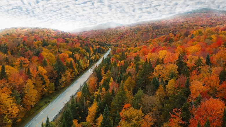
Before you head out for a day trip or plan a vacation for a particular season, you usually check the weather forecast, right? Well, if you want to plan the perfect leaf-peeping fall trip to experience the changing colors of the season, you have to do the same. Whether you dream of visiting this underrated Indiana forest or crossing Virginia's longest recreational bridge through an oasis of fall foliage, timing is everything. The colors change quickly, and missing peak season by even a week can mean missing out on the very best part of the show.
Fortunately, with the help of the fall foliage prediction map by SmokyMountains.com, you can check the forecast and plan your trip to catch the leaves at their most brilliant. This interactive map covers the entire United States, showing exactly when each area is expected to reach its peak color. The map is color-coded, with shades of red representing different states of foliage, from no change at all to well past the peak.
This map is based on more than 50,000 data points that account for meteorological factors (like temperature, sunlight, and precipitation from the National Oceanic and Atmospheric Administration), historical information, unique region-specific tree types, and user-submitted reports (which you can contribute to here). It's updated regularly so that you can receive relevant forecasts as the season progresses. Although it isn't 100% accurate — as fall foliage doesn't have long-term predictability — this handy resource serves as a general guide to help travelers plan the ideal time for their foliage-spotting trips.
How to use the map to plan your trip
Using the fall foliage prediction map is simple. First, choose your destination, whether it's a state park, national forest, or a charming tiny town known for some of the most stunning fall views. Then, look at the map to see when that area is expected to reach its peak — it provides a week-by-week breakdown from early September to the middle of November. For example, if you're planning a trip to New England, you'll see that Vermont and New Hampshire are predicted to reach peak foliage in early October, while states farther south, like Virginia or Tennessee, may not peak until late October or early November.
The timing of fall foliage varies drastically depending on the region. Even within a single state, different locations reach peak color at different times (luckily, the map shows this with precision). Factors like temperature, rainfall, moisture in the soil, and altitude influence when the leaves change color. Higher elevations, such as the Rocky Mountains or the Appalachian Mountains, often see their peak foliage earlier than lower coastal areas (think Florida or Texas). Moreover, the Climate Prediction Center is anticipating a fall season that's warmer than usual for the U.S.
If you're unable to travel at the exact peak time for one location, the map can help you shift your destination to catch the best colors at the right time. To really make the most of your experience, pick a location that you can explore on foot, by bike, or by car; many regions offer scenic byways, hiking trails, and lookouts of the colorful landscape. You can also pair your leaf-peeping adventure with other quintessential fall activities, like apple picking, visiting local farms, or attending harvest festivals.