Trek From Coast To Coast On One Of The Longest Hiking Trails In America
The U.S. is no stranger to extremely long hikes. Two of the most famous are the Appalachian Trail (AT), which runs from Georgia to Maine, and the Pacific Crest Trail (PCT), which goes from the Mexican to Canadian borders, California to Washington. But they're not that long. The PCT is "only" 2,650 miles, and the AT is a measly 2,190 miles. You can knock both of those hikes out in six months.
If you're looking for a real challenge, how about trekking from coast to coast, all the way across America? The American Discovery Trail (ADT) runs for around 5,000 miles from Cape Henlopen, Delaware, to Point Reyes National Seashore, California. Hiking this trail takes an average person 390 days. During that time, you get to experience the full diversity of America's landscapes: mountains and deserts, big cities and vast prairies. So step aside Route 66; we're crossing the country on foot.
Exploring the East
Most through hikers start the ADT on the East Coast and head west, according to discoverytrail.org, so that's where we will begin. Hikers set out from the Atlantic Ocean in Delaware's Cape Henlopen State Park. The Delaware section is just 44 miles. According to one poster on the r/hiking forum on Reddit, that is no bad thing, as this state's section is mainly on paved roads.
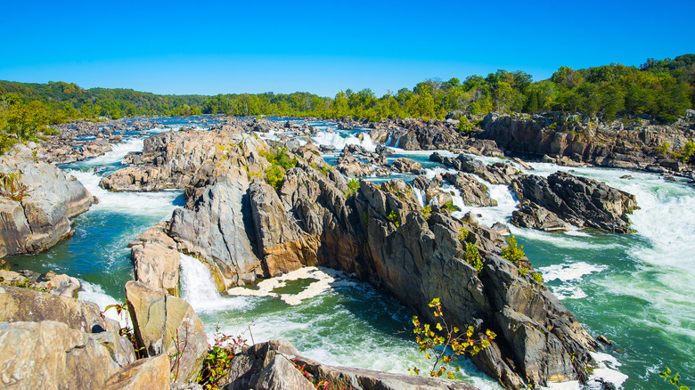
From Delaware, you'll hit Maryland and Washington, D.C., crossing the Chesapeake Bay. You can take a side trip into D.C. and see the stunning Great Falls on the Potomac. Next, you're in West Virginia, where you can spend some time around Harpers Ferry, discovering Civil War history in the area. After this, you'll be on a particularly scenic section of the trail. You'll hike over ancient mountains and in deep valleys and spend some time on the North Bend Rail Trail, which one user on Reddit's r/bicycletouring forum writes has lovely scenery.
Your final state in this eastern section is Ohio (with a dip into Kentucky). You'll pass caves, sandstone hills, and an area called the "Little Smokies," thanks to their resemblance to the Great Smoky Mountains. Think steep hills and dense woodland. From Elizabethtown, you have a choice to make: the northern or the southern route.
Sightseeing in the Center
The ADT splits into two between Elizabethtown, Ohio, and Denver, Colorado. Both routes pass through Indiana and Illinois, but the northern route crosses Iowa and Nebraska, while the southern route goes through Missouri and Kansas. The northern route is slightly over 200 miles shorter than the southern route.
Taking the northern route, you'll pass through Indiana's Midwestern Corn Belt, the flat, northern part of Illinois (you can take a side trip to Chicago), and Iowa and Nebraska's vast corn and bean fields. On the southern route, you'll go through hillier country in Indiana and Illinois before going into St. Louis, Missouri, and crossing the state's limestone bluffs. In Kansas, you'll spend 570 miles walking beside great corn and wheat fields and through small towns.
We're going to be honest: This might not be your favorite section of the trail. As one user put it in Reddit's r/campingandhiking forum, despite having two trails to choose from in the central section, "either way it'll be terrible." We wouldn't go that far, as these states have their charms. However, be aware that though Kansas is relatively flat, it is a tough state to trek through on the ADT. In the r/thruhiking forum on Reddit, one poster wrote that several hikers describe Kansas as the "roughest stretch," partly due to the weather and partly due to the lack of water sources.
West to the coast
Once you've crossed the Midwest, the only way is up. We mean that literally because your next state is Colorado. From Denver, the trail joins up and heads into the Rocky Mountains. The scenery will be spectacular, and hopefully, you'll have your trail legs, as you'll need to cross six peaks that reach over 9,000 feet.
After this, you cross into Utah. The Trek writes that the ADT is the only long-distance trail that allows hikers to really explore this glorious state, differentiating it from all other long-distance hikes. The scenery is wonderfully diverse in southern Utah: You'll cross the red rocks of Canyonlands National Park and hike through high forests, deep canyons, and towering mountains.
From Utah, you go into Nevada, which is not a state that usually attracts hordes of hikers. But that's a shame, as Nevada offers ADT hikers mountain crossings, valleys covered in sagebrush, and a chance to visit Great Basin National Park, where there are over 40 caves to explore. Finally, you reach your last state of California. You enter the state on the gorgeous Tahoe Rim Trail, descend through the Sierras, and pop out on the Pacific Ocean at Point Reyes National Seashore. Here, you can relax on long sandy beaches and find an epic spot to set up your tent for the last time.
Practicalities of the ADT
How do you even begin to plan for hiking the ADT? First, we've been talking about America's longest trek, but you don't have to do this trail on foot. Most of it is open to cyclists; one person has even completed the whole length on horseback. One couple, Bill and Laurie Foot, completed the trail by doing a mixture of hiking and biking. You can do the ADT your way.
Be aware that the weather will present challenges. One Reddit poster in the r/hiking forum wrote that Nevada is a "brutal" stretch, saying that hikers should carry gallons of water in a stroller. Meanwhile, the snow in the mountains in Colorado can also make hiking difficult and perhaps dangerous. With this in mind, you'll need to time your start date well if you want to do the whole hike. Ken and Marcia Powers began in February and ended in October, being the first couple to successfully complete the whole trail in one continuous go.
Finally, one user on Reddit writing in the r/hiking forum suggests using the official ADT as a guide and planning your own route. The ADT meanders, and there are often faster ways to walk between towns, so you may want to skip some parts. Hike your own trail.
